GEOL 505
Imaging and GIS in Disaster Response
The purpose and scope of this class is to expose the students to a broad array of Disaster Response problems and opportunities for a range of solutions. By focusing the class on real events and particularly on real natural disasters if they occur during the semester, it is possible to demonstrate both approaches and solutions. The class is thus meant as a mentorship toward being able to actually help during a global disaster. As such, the quality of the assignments, the means of solving problems, and the relationship to others in the class all working as a team are vitally important to learn how Disaster Response is done.
- Specific topics to be addressed during the class include basic background to remote sensing and GIS, types of imagery and processing, ways of getting imagery and using it, and collaboration tools and linkages to the field. Topics will primarily be focused on what is used in disasters, which means nearly everything must be free, be available on open-source networks, and utilize services that others pay for (Other People's Money, OPM). Tools such as Google Earth, Google Earth Engine, Google Earth Map Maker, OpenStreetMap, TNT Mips, ESRI ArcGIS and ArcGIS Explorer, Walking Papers, Field Papers, MapKnitter, and a host of other software and web services will be utilized and integrated.
- Legal guidelines and protocols for use of in US disaster responses like NIMS, ICS, NIPP, and NRP.
- Legal guidelines and protocols for International disaster response like DoD Directive 3000.05.
- Social Media such as Twitter and related tools for near real-time information for disaster response, building patterns on which to put dots ("dots on patterns").
- Data fusion and visualization, knowledge management, collaboration, real-time synthesis, and decision support including simulations and game environments.
- Imaging technologies, capabilities, platforms, principles, and electromagnetic spectrum, technologies, laws, current and future uses, and commercial service providers like SeaSpace.
- Active imaging: Technologies, image processing, examples of use such as containers, port and borders, airports, maritime domain awareness, and land mine detection and removal.
- Passive imaging: Technologies, data manipulation, change detection, and fusion of imaging and textual data, hybrid imaging and applications such as RFID and other chip technologies focused on Location-Based Services.
- Cybersecurity, data mining, and security management standards and trends/opportunities.
- UAV (Unmanned Aerial Vehicle) and AUV (Autonomous Underwater Vehicle) considerations, mapping, mosaic formation, GIS, linkage to Social Media such as during fires and earthquakes.
- Funding architectures: DHS, DOJ, NIJ, NASA, TSA, DOT, DTRA, DOD, OSD, DOC, NOAA, USAID, and other agencies and modes of funding (UASI, block grants, state OHS and OES, and other International funding opportunities such as World Bank, Development Banks, Gates Foundation, EU, UN, other countries).
- Role of Native American funding in Federal contracting such as for USAID and DOD.
Focus of the class will be on learning how to use both remote sensing imagery and Geographic Information Systems linked to imagery. Much of the effort will be on trying to help understand what you could do as a leader or official or volunteer in a disaster with the understanding of using imagery and GIS through time to help make decisions. By understanding what can be done and why, it is hoped that you will be able to continually learn as the field grows and as the applications pervade smartphones, utilize cloud computing, and enable rapid decision making on a global scale. We will also use web sites such as Grants.gov extensively as well as Twitter, Instagram, Snapchat, and other Social Media tools, much of this designed to help prepare you to actually use these tools in your careers ahead and see how to get funding for your agency or jurisdiction to enable using these tools.
Course Structure and Conduct
Course will be structured primarily as a lecture-discussion class with instructor leading the discussion around current events in Humanitarian Assistance Disaster Response (HADR) such as major international natural disasters and other global political events such as the current conflicts in Syria, Columbia, Democratic Republic of Congo, South Sudan, Mexico, and other areas.
- Style of the Course will be Lecture-Discussion and students will be expected to participate in the discussion, including using social media like Twitter to understand how such tools work.
- Individual and Group Activities will both be used as disaster response is profoundly a team effort. Many of the assignments will be done as small groups of students, but with each individual turning in separate, but related deliverables.
- Technology utilized in the course will hopefully be useful away from school so you are encouraged to bring and use you own laptops. School computers also fit because we are mostly using web services from the Cloud. We will also seek to work with technologies applicable to non-US and cross-border concerns including efforts inside Mexico, as with mapping, telecommunications, and imagery acquisition such as with UAVs in Mexico where they are not nearly as restricted as in the US, so much more like global disasters.
- Additional opportunities to learn will be available such as the beginning and advanced DHS Texas A&M Extension classes in Threat and Risk Assessment. These will likely be available at this semester and are free to the student though they cost DHS several hundred dollars per student. The classes will be helpful and highly useful for the professional field of Homeland Security and disaster mitigation and response, but will not count toward grade. They are in addition to the class and are strictly voluntary. Materials from the class will be provided to the students attending the class by DHS, as will a Certificate of Completion for each class. Listing these classes on your resume along with the several ICS classes from FEMA that I will ask you to complete is extremely appropriate.
During the semester, if any major natural disasters or major Homeland Security events occur, class will likely focus on the use of imaging and GIS for assisting in the response to these events, especially cross-border events or opportunities. Major disaster events will also be things we address, likely in concert with groups like CrisisMappers. A simple example could be a major winter storm or spring floods in US or earthquake or tsunami or typhoon or volcanic eruption in areas like Indonesia, Mexico, Columbia, Vietnam, or Somalia where we are deeply involved with other universities in trying to help.
Course Materials
Nearly all the materials such as reading materials will be from online sources so that students should be able to access and copy the materials as PDF and other formats. This is purposefully done as most people who use Imagery and GIS in disasters are doing it from web resources, so you will also see how to teach others. Other materials such as DHS materials on the Incident Command System (ICS), National Incident Management System (NIMS), and the National Response Framework (NRF) that are integral to disaster responses in the US will be from DHS and FEMA websites. Significant materials will be sought out individually and in small groups via web and social media sources. Twitter, Google, and other tools will be widely used, as will online tools for analysis of these near real-time data inputs. Significant time and energy will also be put into teaching students how to pursue outside funding, which is one of the most common requirements for being able to work in disasters. Tools such as Grants.gov will provide significant materials for projects and directions for individuals and groups, much as for your careers.
Most of the course materials will be available online and free to you. This is both so that you can use them personally and also that you can share as you likely assist others in using imagery and GIS in disasters. Examples will be tutorials from NASA and NOAA, TNT Mips software (free version), ESRI ArcGIS Explorer, and Open-Source software such as OpenStreetMap.org and family of products and services like Google Earth Engine and Google Earth Map Maker. Several very special groups led by Open-Source groups like Crisis Mappers and commercial companies doing humanitarian assistance disaster relief like Google Crisis Map and the ESRI Disaster response group are leading the way with free tools, techniques, and expertise---so we will follow their lead in a major way. Using tools that you can share with others is powerful and scalable.
I ask that you not work on external projects or communication during class, like working on your Facebook page or wedding preparations or projects in other classes. This is especially true when we have guest speakers, as you represent SDSU.
I would also ask that you carefully clean up your space after class so that we leave the room in better shape than we inherited it, as there is generally no janitorial service in the rooms because of the state budget situation. CSL 427 is one of the Geology departmental computer rooms, so food and drink are best left outside the room when we use that room. CSL 422 is a special room with a fume hood for special organic materials, so food and drink (even empty containers in the trash) are not allowed by Fire Marshall, so we will want to honor that. Putting chairs neatly back into benches and cleaning up other things is a very gracious use of the room.
We will also likely participate in a number of online and distributed learning efforts, where students will engage in the collaboration electronically, so working to use appropriate Cybersecurity and professional presentation in an electronic format will be done. Examples will be listening to World Wide Human Geography Working Group (WWHGWG) and the CrisisMappers webinars on disaster response and real disasters. When we are on conference calls, making sure you know how to mute your phone so that everyone doesn't hear your dog barking or airport announcements is really important.
Enrollment
This class is meant as an Introduction to many of the current solutions in Disaster Response for real people, rather than what the military or major government resource can accomplish given time and millions of dollars. Rather this is meant as what can real people helping in real disasters do--what can YOU do? Because the problems and solutions transcend so many fields, the richness of the class composition will help determine the specifics of projects and approaches.
Grading
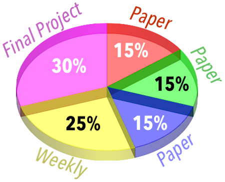
Course will be graded by combination of three short papers (depending on whether natural disasters occur, so we will focus on the real disaster rather than papers), small weekly assignments, and a final project:
- Three papers will be evenly spaced throughout the semester and will focus on specific uses of Imaging and GIS in disasters so that you have the vision and framework for how Imaging and GIS can actually help in disaster response and humanitarian assistance. Each will be 15% of the grade.
- Shorter weekly assignments such as working on Grants.gov, Twilert, Geofeedia, Snapchat, HootSuite, Crisismappers.net, OpenStreetMap.org, Ushahidi, UN ASIGN, Sahana, Pacific Disaster Center, and other tools will be assigned and will add up to a total of 25% of the grade.
- Final project and presentation of the results in front of the class will be 30% of the grade and focused on one aspect of the course chosen and presented in front of the group. Final projects will hopefully provide real-life experience in doing Imaging and GIS for Disaster Response and Humanitarian Assistance. Many of the projects will focus on specific areas such as specific areas in Mexico, Columbia, Congo, South Sudan, Syria, Kazakhstan, Indonesia, and other areas on which we may work.
- Excused Absence Make-up Policies: Most of the students are working adults with complex travel and daily lives. Generally possible to work with individuals who are not able to make class for valid reasons. Simply contacting instructor prior to class is best way to approach this and can individually arrange to make up the material.